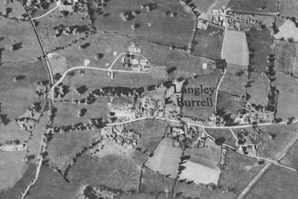
Heritage and History
- All
- Buildings
- Heritage
- Nature
- SSSI
- General
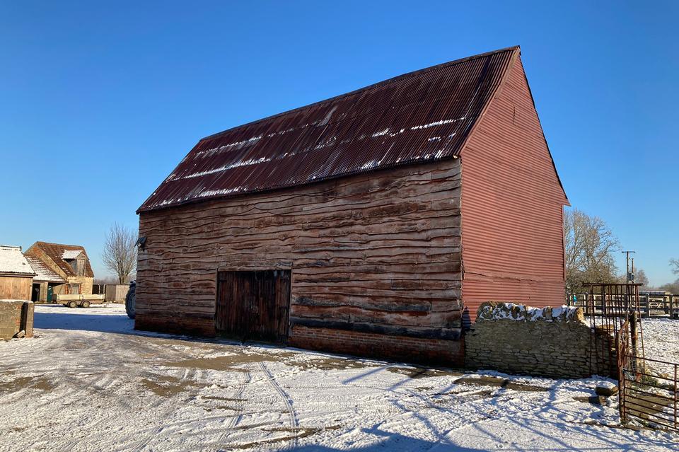
Barn
at Manor Farm
Barn, late C17 or C18, timber-frame clad in weatherboard with corrugated iron roof and east side lean-to. Brick plinth. Said to have inscribed date of 1680.
Read More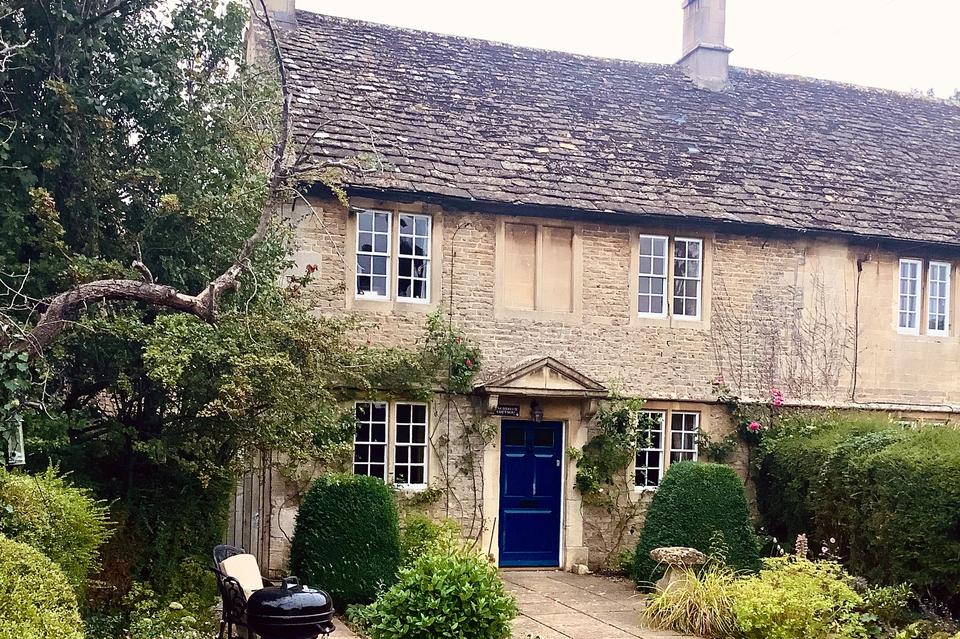
Pinchloaffe Cottage
Pinchloafe Cottage is a grade II listed semi-detached cottage dating from the eighteenth century. Like its neighbour, Home Farm, it is built in typical Cotswold-edge fashion of rubble stone.
Read More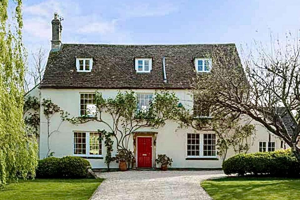
Langley Cottage
Langley Cottage was built in the eighteenth century and altered during the early nineteenth century. During the early 1870s, the Warrilow family lived at the house.
Read More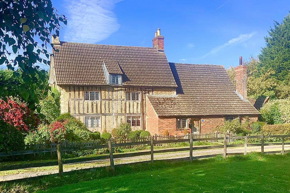
Barrow Farmhouse
The farmstead or small settlement of Barwe lay immediately east of Birds Marsh.
Read More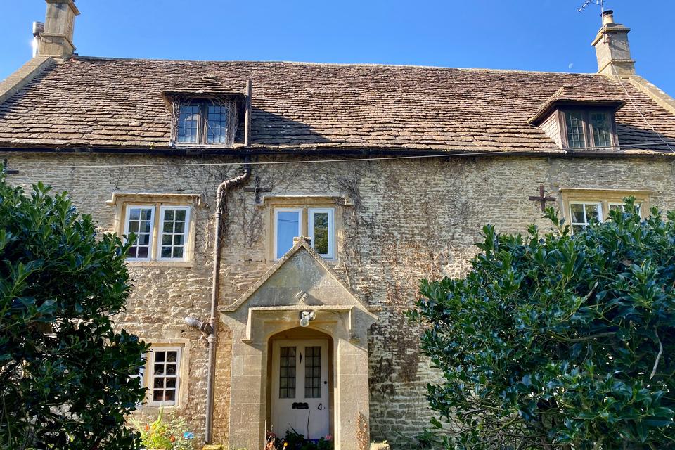
Jacksom's Farmhouse
Grade II listed Jacksom's Farmhouse was originally built in the seventeenth century. It was altered in the eighteenth century when the barn was also added.
Read More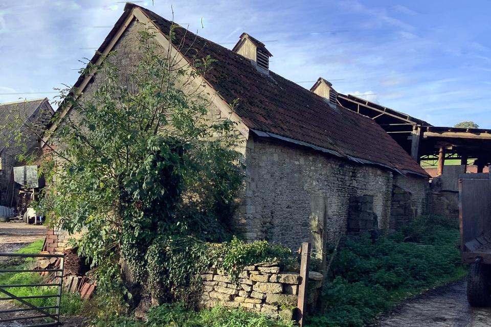
Barn
at Jacksom's Farm
Grade II listed Jacksom's Farmhouse was originally built in the seventeenth century. It was altered in the eighteenth century when the barn was also added.
Read More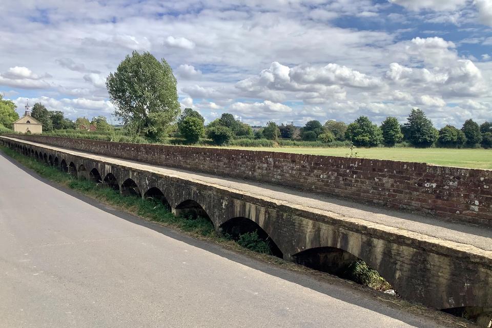
Raised Sections
Maud Heaths Causeway
In 1474, an endowment was made by a Kellaway's woman, Maud Heath, to build and maintain a causeway from Bremhill to Chippenham. The elevation of the path was particularly important where the river often flooded the fields.
Read More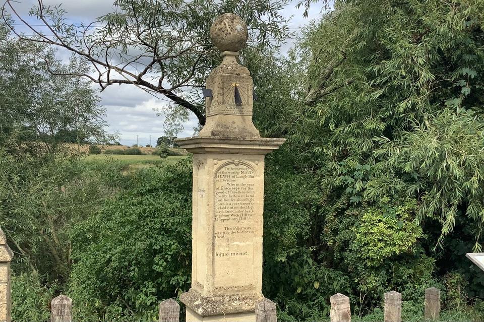
Maud Heath's Monument
Kellaways
The first known public declaration of Maud Heath’s intentions was made by the trustees in 1698 when they set up a memorial pillar by Kellaways Bridge.
Read More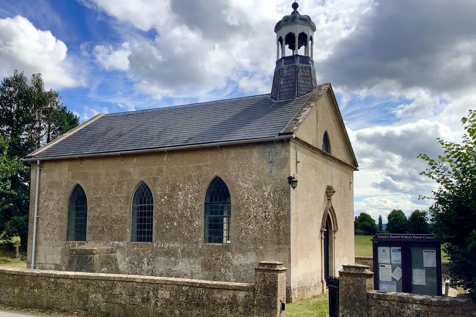
Church of St Giles
The original chapel of St Giles, Kellaways, was constructed by the Keylways family and built by 1304. Later it became the parish church of Tytherton Kellaways.
Read More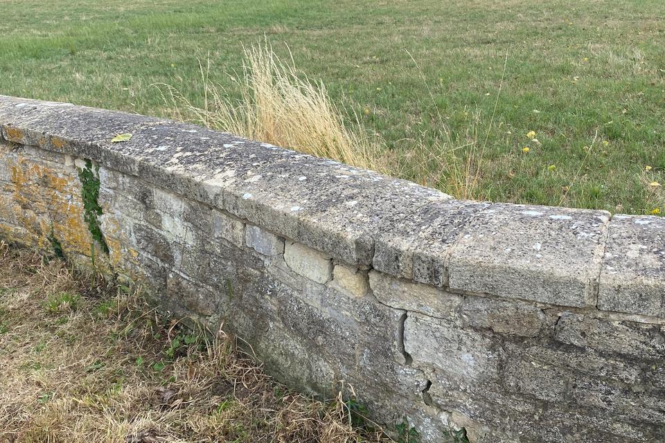
Churchyard Wall
Church of St Giles
The low ashlar and rubble stone wall around the churchyard of St Giles is grade II listed. It was built at the same time as the church during the early 1800s and was ordered to be constructed using materials from the original chantry chapel of St Giles.
Read More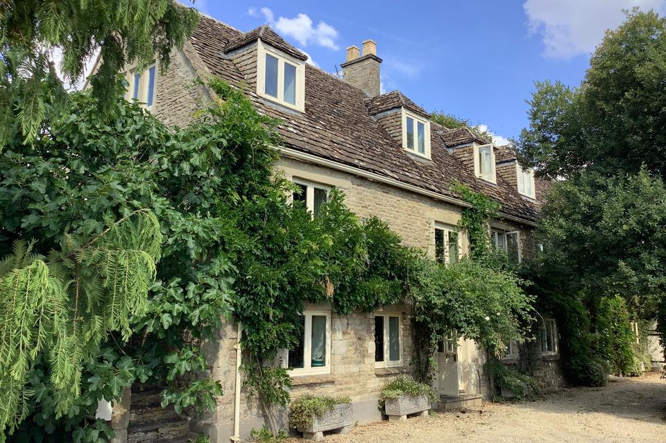
Kellaways Mill
In 1654, George Knight brought Kellaways 'Mills'. There were three separate water mills on the site, one of which was grinding grain, two were fulling mills involved in the manufacture of woollen cloth.
Read More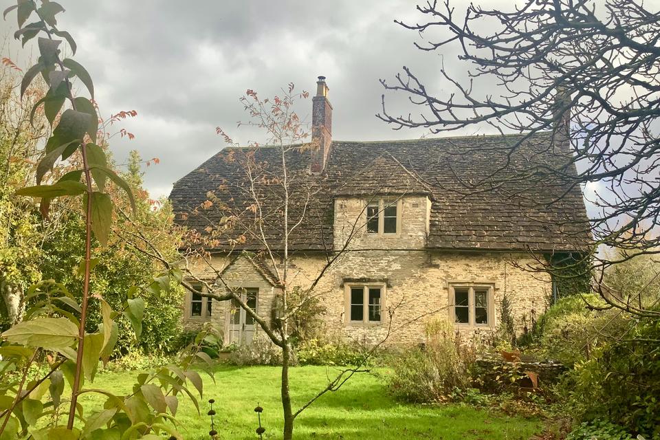
Lower Peckingell Farm
In the early 1870s, Lower Peckingell Farm (or Peckingell as it was then known) was a dairy farm of about 70 acres occupied by the Austin family.
Read More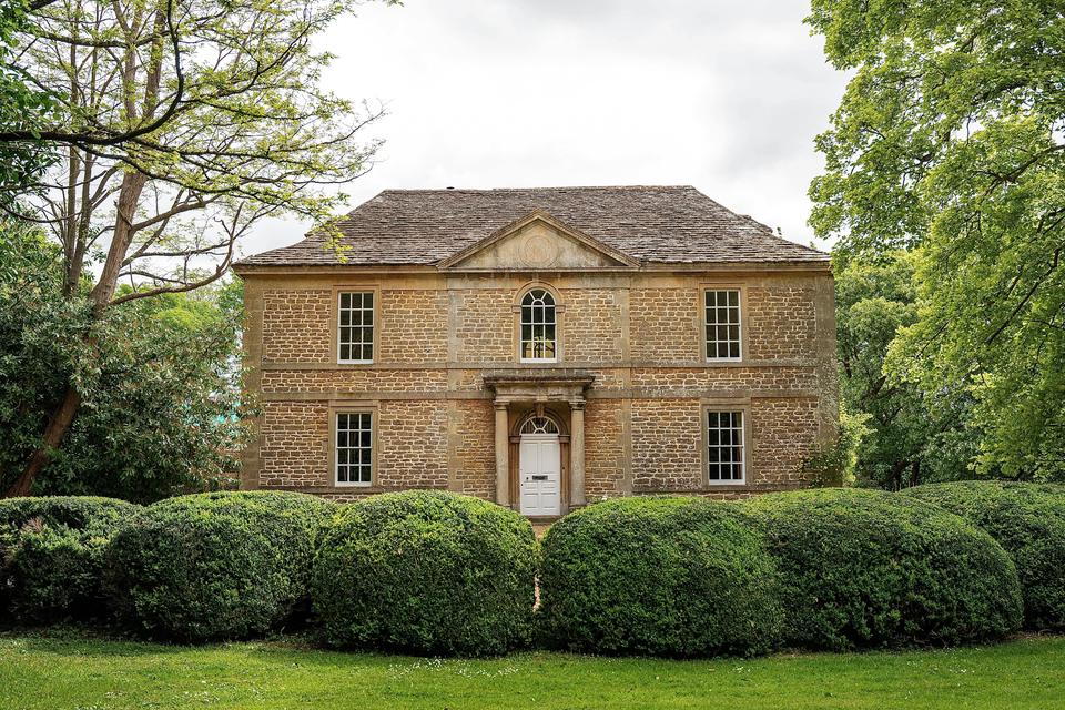
Kilvert's Parsonage
Kilverts's Parsonage was used as the residence for the rector of Langley Burrell for over a hundred years however, the building significantly predates the tenure of the Kilverts.
Read More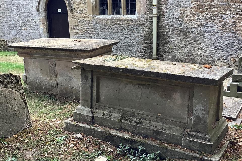
Coleman and Lessiter Tombs
Church of St Peter's
Two chest tombs, C18 and early C19, ashlar: Mary Coleman memorial, early C18, Lessiter memorial, c1800.
Read More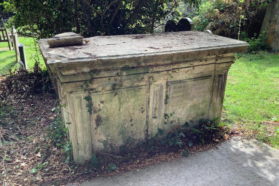
John Eddolls Monument
Church of St Peter's
Chest tomb, mid C18, ashlar with two shield plaques each side, moulded base and cornice with pulvinated frieze broken forward over fielded centre and angle piers. Inscription to John Eddolls.
Read More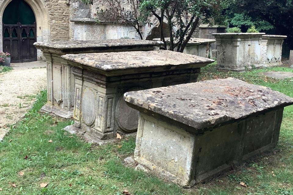
Three Eddolls Tombs
Church of St Peter's
Three chest tombs in line, C17 to mid C18, ashlar: E.B. Eddolls monument, mid to later C18, Mary and Edward Eddolls monument, early to mid C18, Edward Eddolles monument monument, late C17.
Read More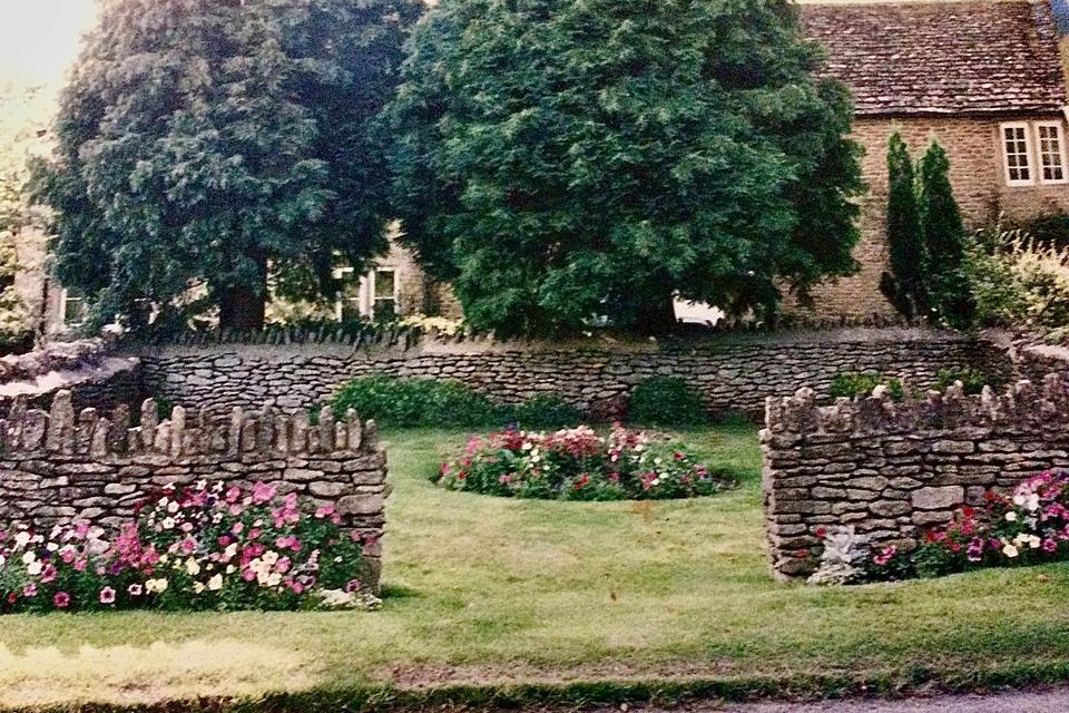
The Pound & The Common
In 1838, Langley Burrell Common comprised of about 84 acres of open pasture. It formed a thin strip on either side of the lane to Tytherton Kellaways. At the northern tip of this area of common was the village pound.
Read More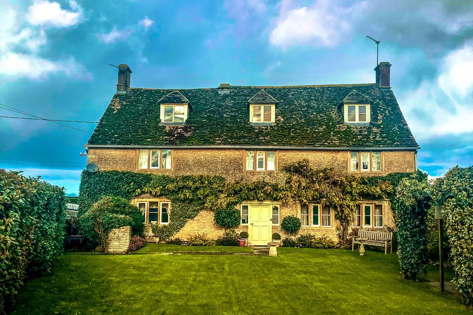
Manor Farmhouse
The manor farmhouse dates from the seventeenth century, possibly built by the Ashe family after they brought the manor of Langley Burrell in 1657.
Read More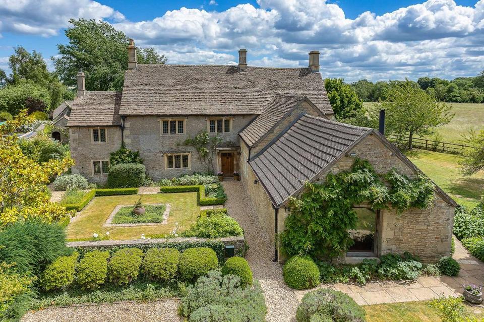
Common Farmhouse
The grade II listed stone farmhouse with stone slate roof has a plaque that reads 'CAL WH 1636'. Although dating from the seventeenth century, the house was altered during the eighteenth century.
Read More
The Old Brewery
Langley Brewery at Langley Burrell was established by 1822, when it was run by a John Sheppard, although the Brewery’s origins lie further back in the eighteenth century.
Read More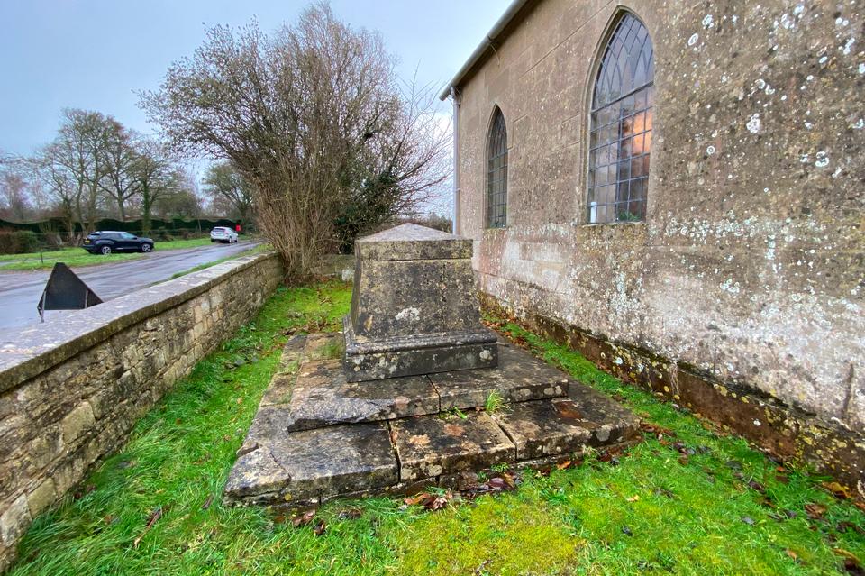
Unidentified Tomb
to Noth of Church of St Giles
Unidentified tapered pedestal monument, early C19, ashlar, large scale on two broad stone steps. Moulded base and pyramid cap.
Read More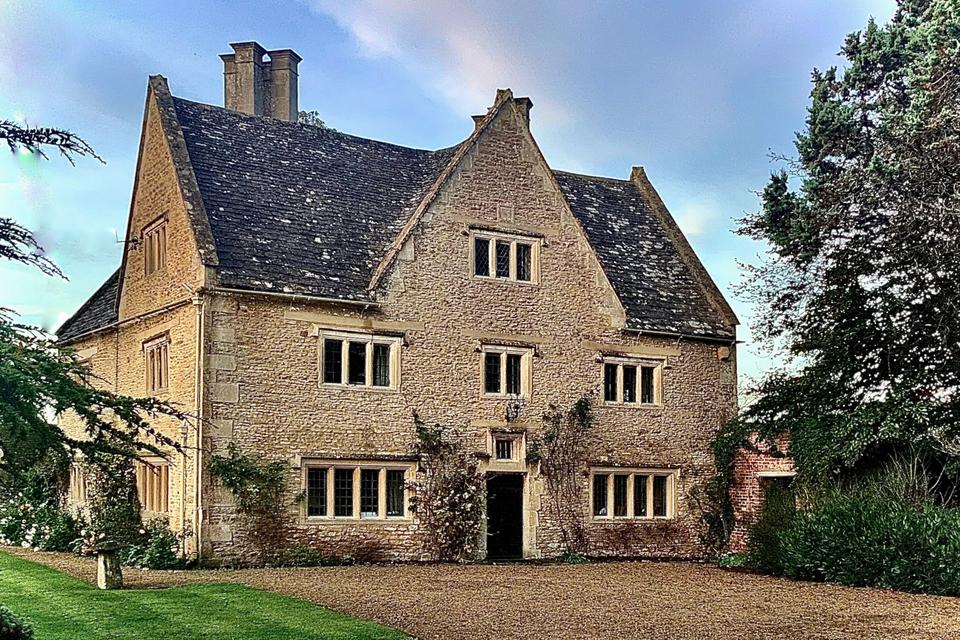
Kellaways Farm
Kellaways farmhouse is believed to be the manorial residence within the hamlet. Much of the now grade II* listed house dates from the seventeenth century.
Read More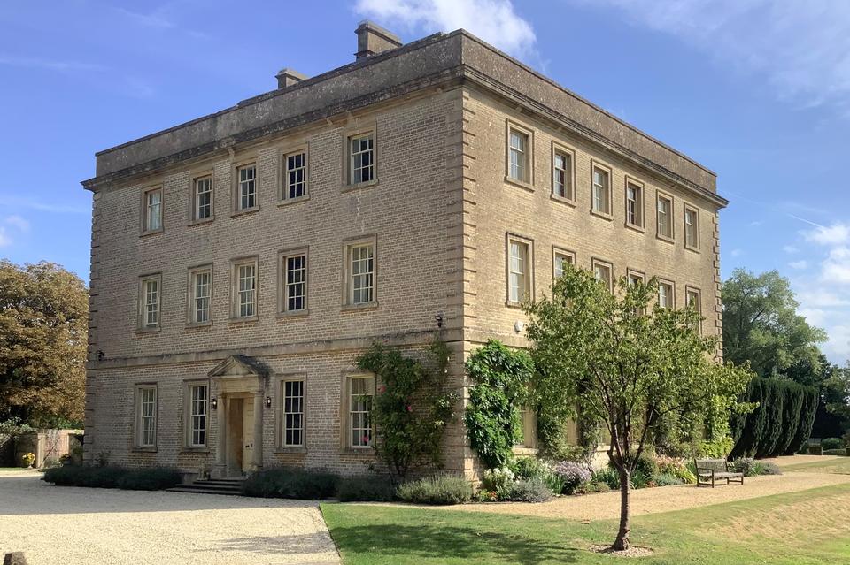
Langley House
An examination of estate accounts suggests that the present house was built by Rev Robert Ashe who inherited the estate and the mansion in 1758. The date for the construction was 1766-9
Read More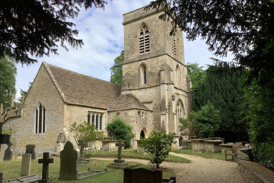
Church of St Peter's
The impressive church of St Peter's, Langley Burrell, incorporates elements from before 1200.
Read More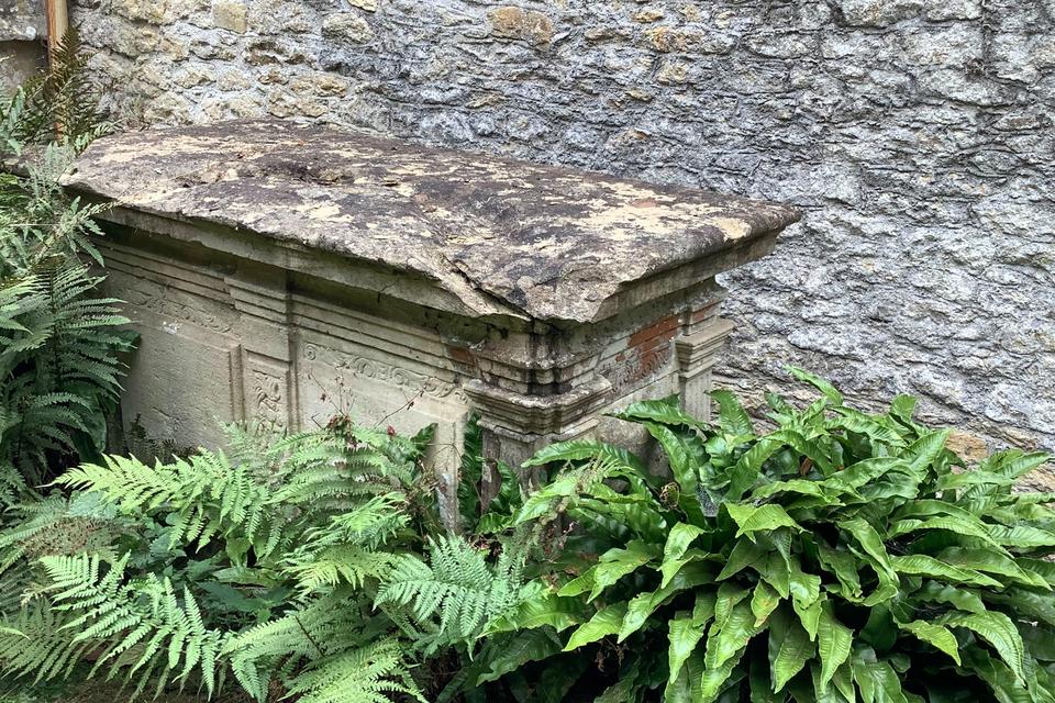
Buy Monument
Church of St Peter's
Chest tomb, mid C18, with two shield plaques each side. Inscription to Ann Buy died 1763.
Read More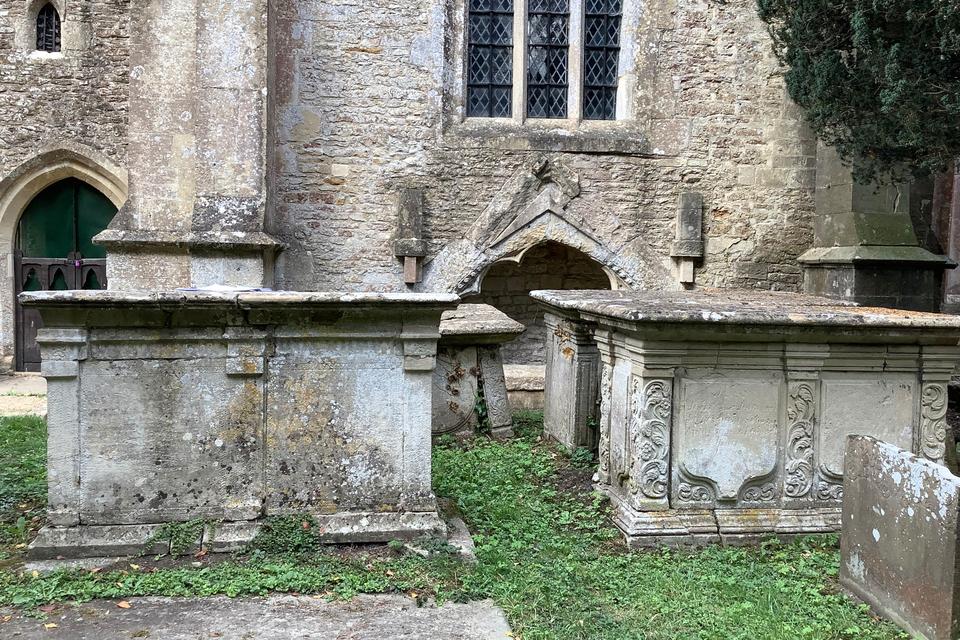
Four Chest Tombs
Church of St Peter's
Four chest tombs, C18, ashlar. Two unidentified monuments. Other two are John Wilkins monument, John and Mercy Wilkins monument, mid C18
Read More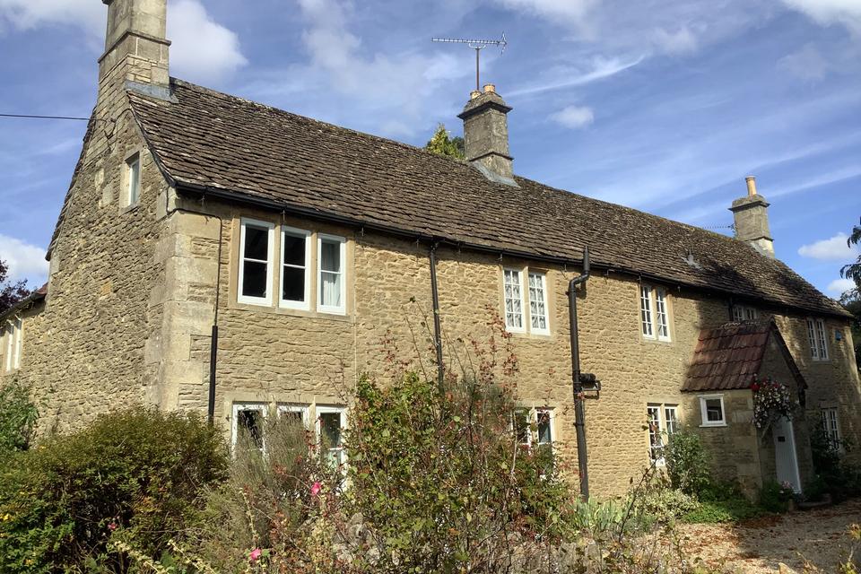
Pound Cottage
Pound cottage was formerly a row of three cottages with an interesting history. These buildings dated from the C18 and were likely built as labourers' dwellings.
Read More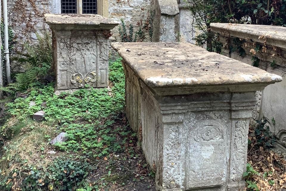
Five Chest Tombs
Church of St Peter's
Five chest tombs, C18, ashlar: Wastfield monument, mid C18, finely detailed, S. Matthews monument, early to mid C18, J. Matthews monument, early C18, Unidentified early to mid C18 monument, S. Jefferys monument.
Read More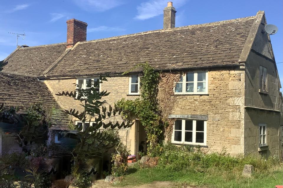
Grove Farmhouse
Grove farm was also formerly known by the name of Langley Grove. When Francis Kilvert wrote his diary in the 1870s, the Lessiter family occupied the farm.
Read More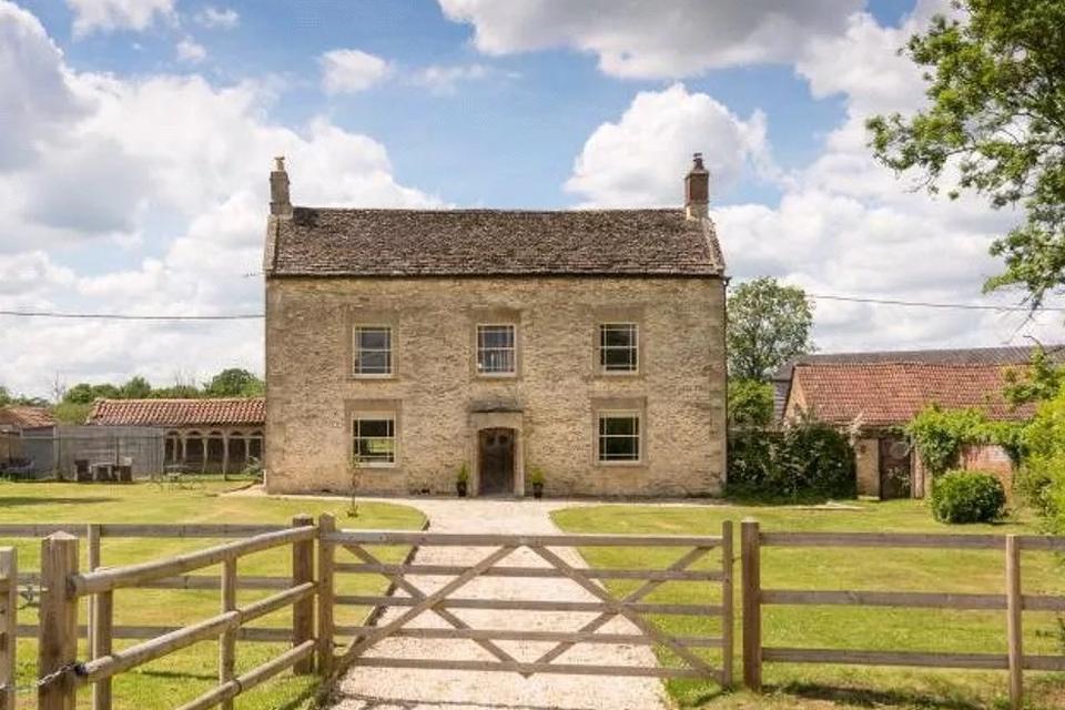
Upper Peckingell Farmhouse
In 1223 the Abbot of Glastonbury Abbey, evidently dissatisfied with the shortage of meadow land on his estate of Langley Fitzurse (Kington Langley), purchased 115 acres of rich pasture known as Penicroft (Peckingell)
Read More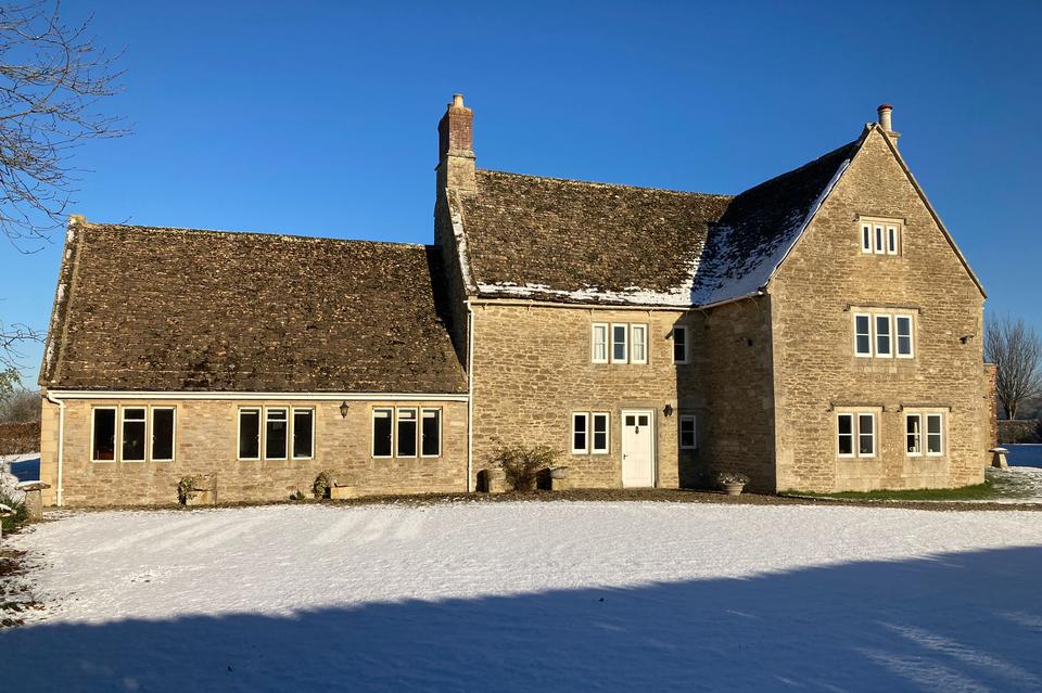
Manor Farmhouse
Avon
Manor Farm on Avon Lane was formerly called Avon farm. It was occupied by Hugh Beames, a progressive 'gentleman' farmer during the late eighteenth century.
Read More
32-35 The Common
32-35 The Common was originally a group of five (later four) cottages. In 1842, four were estate cottages occupied by agricultural labourers.
Read More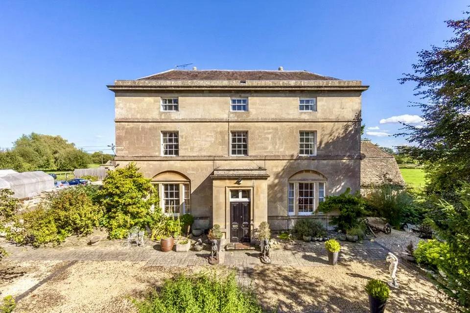
Langley Green House
From its formal three-storey, three-bayed front, Langley Green House looks like an elegant Georgian house. Its origins, however, date from the fifteenth century when it was built as a single-storey timber-framed cruck house.
Read More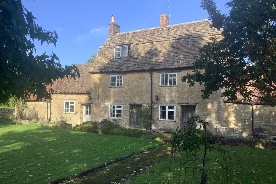
Barrow Cottage
Barrow cottage was once two cottages. It dates from the late seventeenth and eighteenth centuries.
Read More
Kellaways Mill House
In 1803, a simple floor plan was made of the dwelling house attached to Kellaways mill. The home was formed of a large living area downstairs with two hearths and a door and windows to the front and rear.
Read More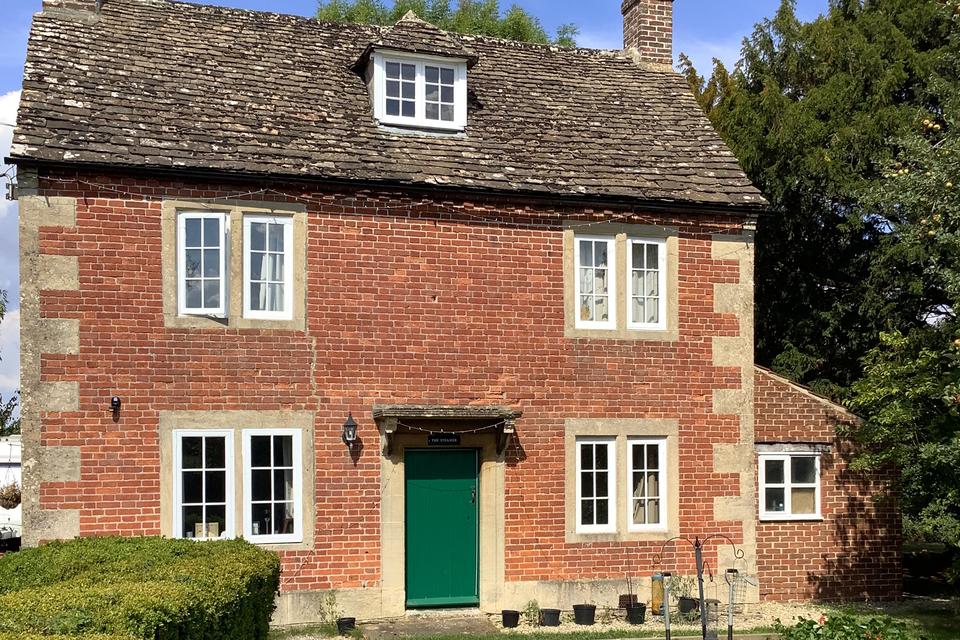
The Steamer
Although the Steamer Inn was never listed in trade directories for Langley Burrell, in 1871, the census taker noted a building in the village had formerly housed the Steamer Inn.
Read More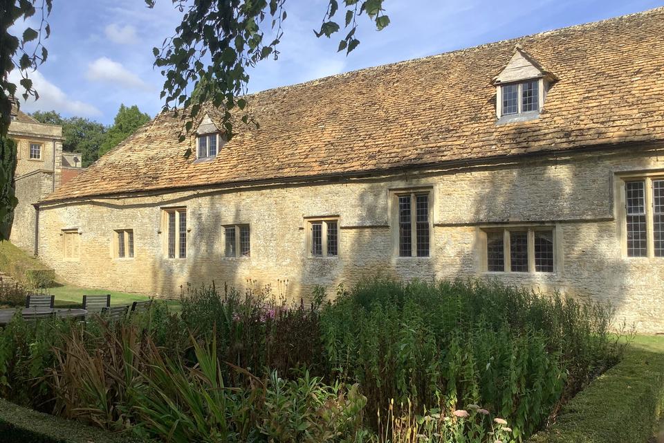
Stable Block
at Langley House
The present Langley House was built in the 1760s to replace an earlier structure. The original stable block to the north of the house, dating from the seventeenth century, was retained.
Read More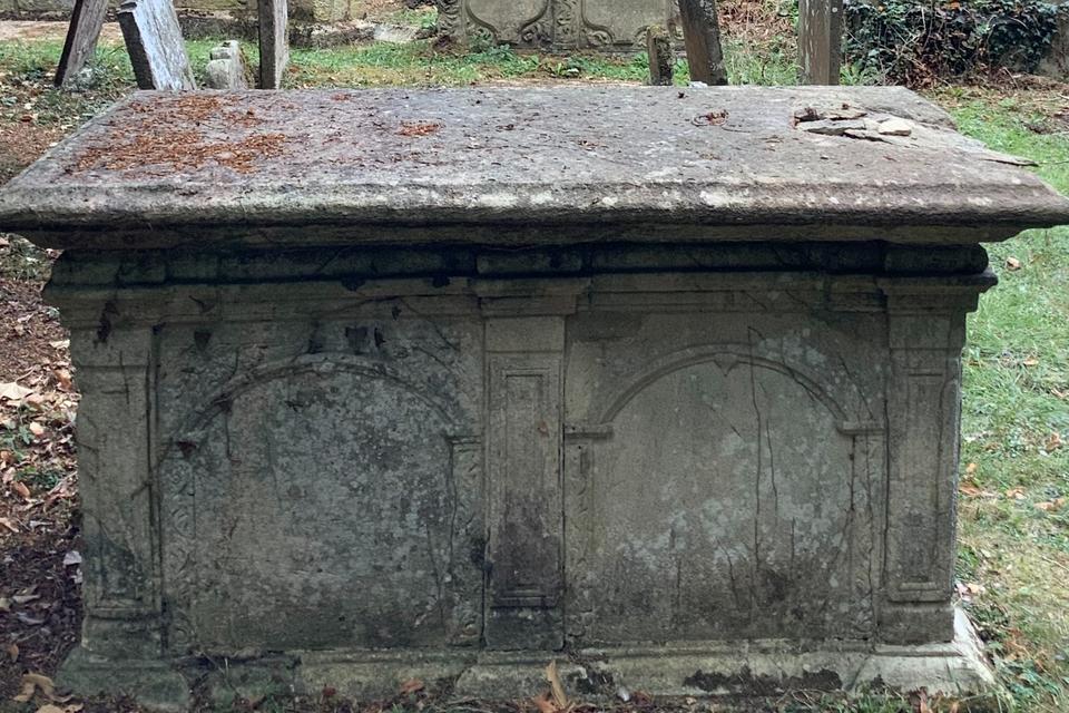
Two Chest Tombs
Church of St Peter's
Two chest tombs, C18, ashlar. Knight monument, mid C18, unidentified monument, earlier C18 and two arched-headed plaques.
Read More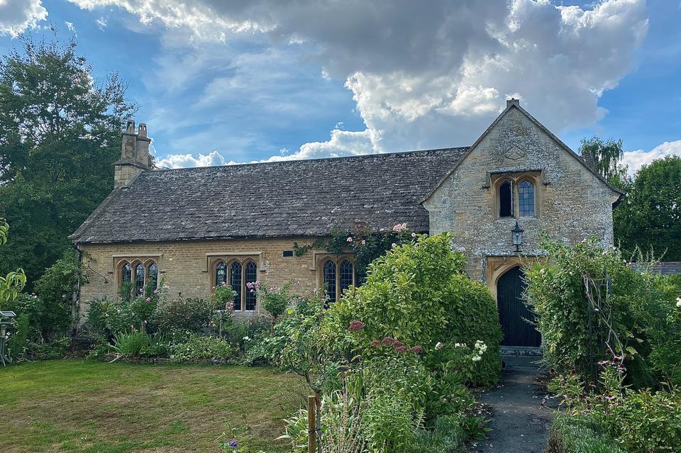
The Old School
The school was built in 1844 for the lord of the manor of Langley Burrell, Rev Robert Ashe. Substantially built, the single-story T-plan building that included a teacher's house proudly bore the Ashe arms.
Read More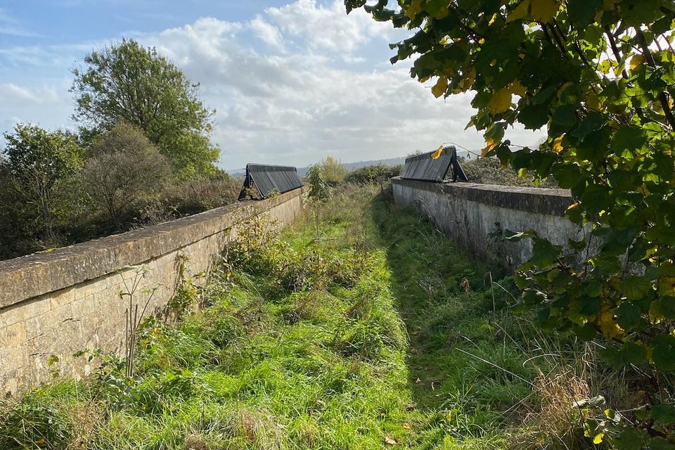
Green Bridge
A triple-span accommodation bridge with semi-elliptical arches, erected over a cutting c. 1839-41. Elegant triple-arched form, constructed in Bath stone, probably intended to create a dignified entrance to Chippenham.
Read More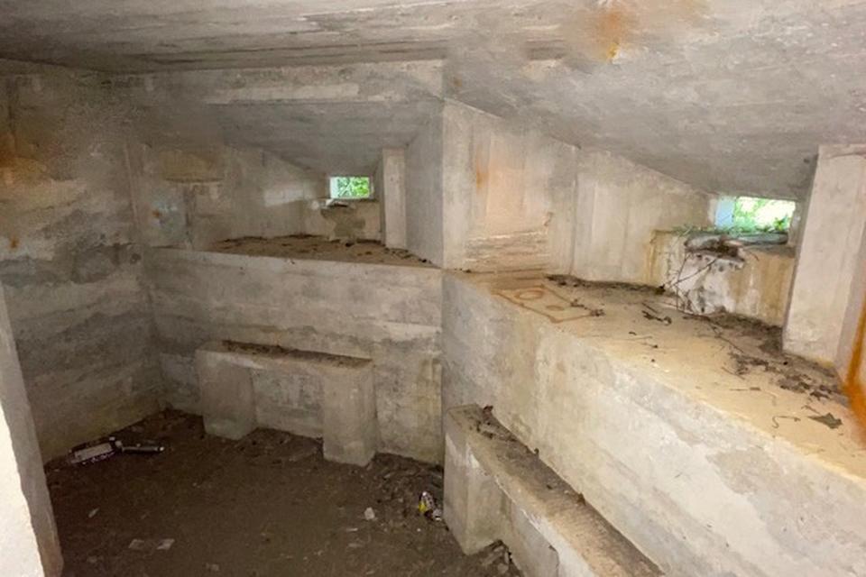
WWII Pill Box
near footbridge, South of Kellaways
Pillboxes are small concrete emplacements that were typically equipped with loopholes through which to fire weapons. They were built in the early 1940s as part of local anti-invasion preparations during WWII.
Read More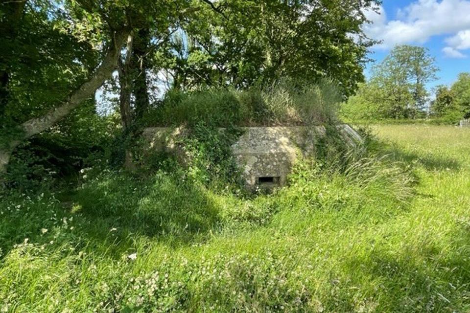
WWII Pill Box
between Peckingell & Thyerton Lucas
Pillboxes are small concrete emplacements that were typically equipped with loopholes through which to fire weapons. They were built in the early 1940s as part of local anti-invasion preparations during WWII.
Read MoreWWII Pill Box
near Rawlings Farm
Pillboxes are small concrete emplacements that were typically equipped with loopholes through which to fire weapons. They were built in the early 1940s as part of local anti-invasion preparations during WWII.
Read More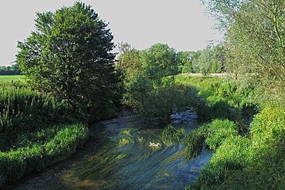
Kellaways Rock
SSSI
A 4.1 hectare geological Site is of geological interest as the banks of the River Avon expose Callovian highly-fossilferous sandstone which contains well-preserved bivalves, Gastropoda, Branchiopoda, belemnites and ammonites.
Read More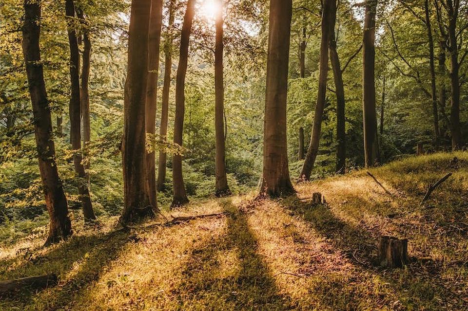
Bird's Marsh Wood
Birds’ Marsh was not always Birds’ Marsh. In 1586, a manor survey of Langley Burrell described the common of the estate as including an area it called ‘Burchen Marsh’.
Read More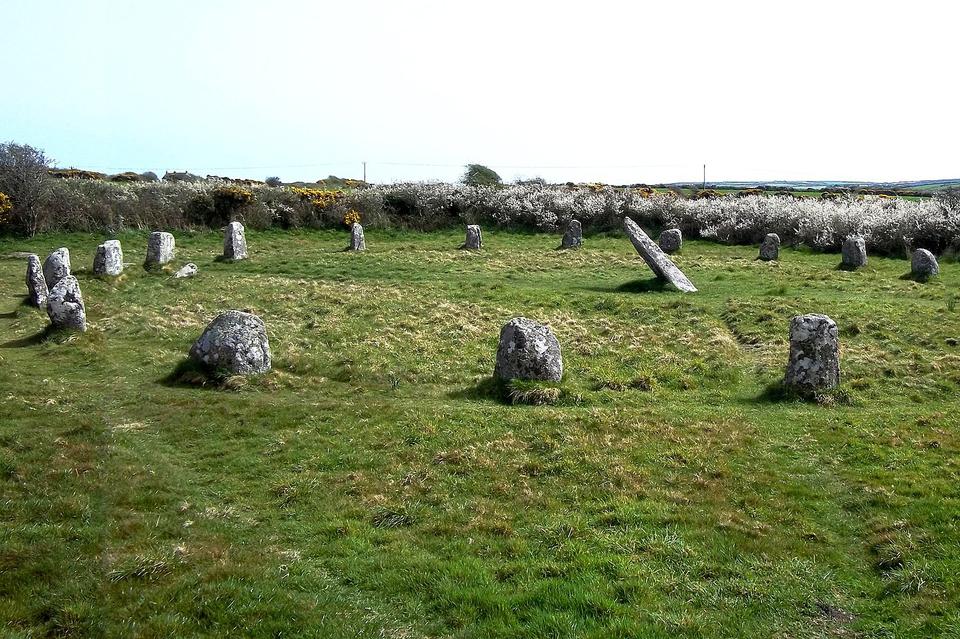
WWII US Army Camp
In December 1943, 31 acres of Common Farm, part of Langley Burrell estate, was requisitioned for military use as a tented camp. Subsequently, the 355th General Engineer Service Regiment, part of The Corps of Engineers of the American Army, built a base on the site.
Read More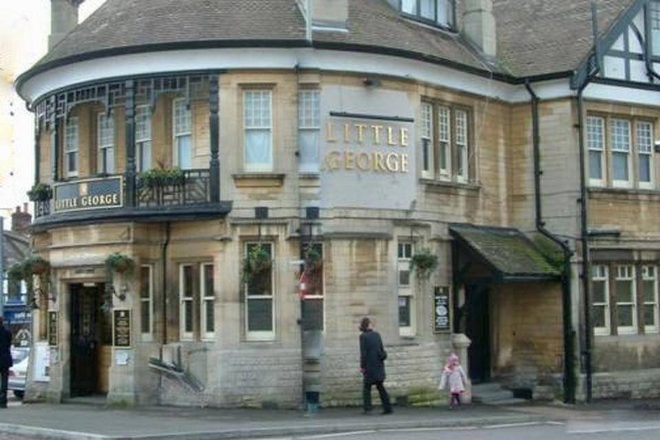
Little George Pub
Formally Langley Burrell Parish
The Little George public house, Langley Burrell once stood at the end of Maud Heath's Causeway however, it is perhaps most notable for a 'barbarous and blood-thirsty conflict'.
Read More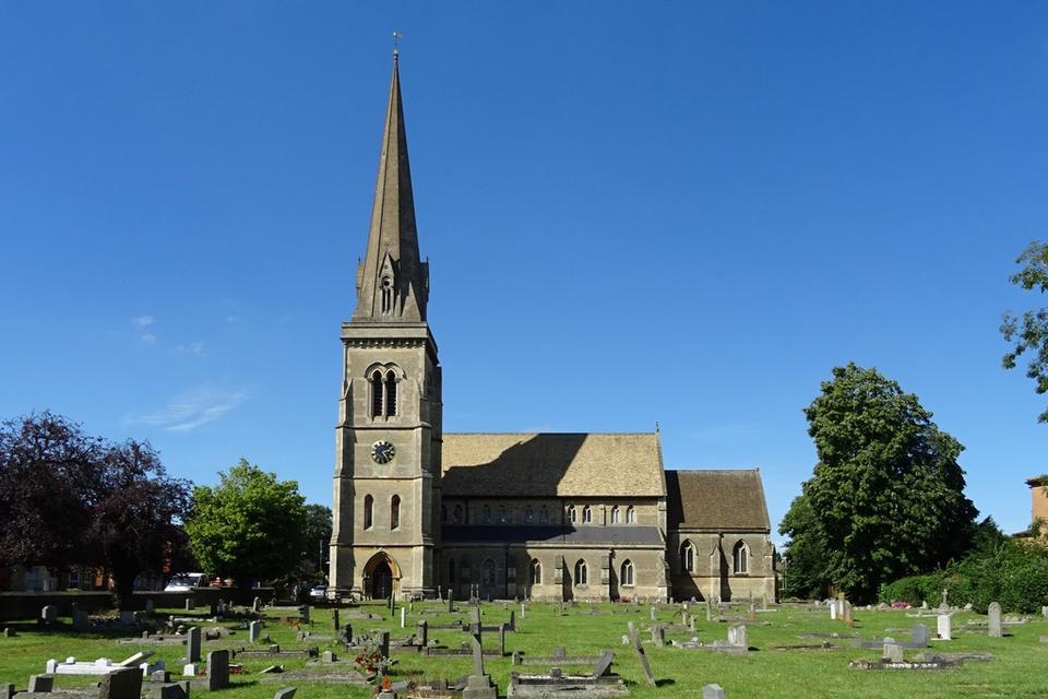
St Paul's Church
Formally Langley Burrell Parish
By the early 1850s, there was an identified and urgent need for a new church to serve the 400 Langley Burrell residents in the new suburb of Chippenham as the village church of St Peter's was a mile and a half from the parish church.
Read More
Medieval Settlement
near Barrow Farm
The site of a farmstead or small settlement of Barwe lay immediately east of Birds Marsh and extended southwards to Barrow Farm. Series of earthworks, barrow and signs of moat indicating significant medieval settlement in that area (see long description Barrow Farm)
Read More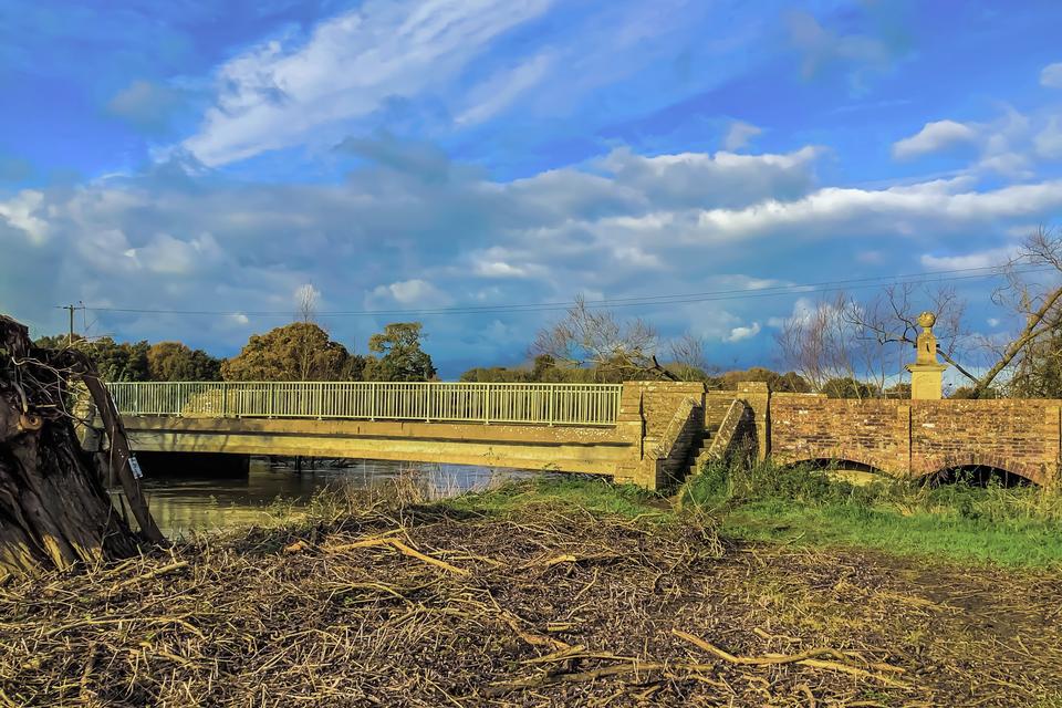
Kellaways Bridge
For centuries inhabitants from the area surrounding Langley Burrell trudged through the village on their way to the weekly market in Chippenham. In 1474 a gift was made by a wealthy widow, Maud Heath, for land and the construction of a raised path so that those going to market could remain dry-shod.
Read More
Marsh Farm
Although not a building listed by Historic England, this house is nonetheless a fascinating historic structure. It was originally a two-roomed farmhouse, likely dating between 1590 and 1620.
Read More
Iron Age Settlement
Kellaways
To the east of Kellaways, there is evidence of occupation from the Iron Age in the form of a banjo settlement and strong indication of Roman occupation in the parish lies in the area around Bird's Marsh.
Read More
Romano-British Farmstead
Near Barrow Farm
To the east of Kellaways, there is evidence of occupation from the Iron Age in the form of a banjo settlement and strong indication of Roman occupation in the parish lies in the area around Bird's Marsh.
Read MoreMedieval and Post Medieval Settlement
South of Langley Lodge
Alongside evidence of Iron Age and Roman settlement within the parish, documentary evidence for habitation dates from the Anglo-Saxon period.
Read More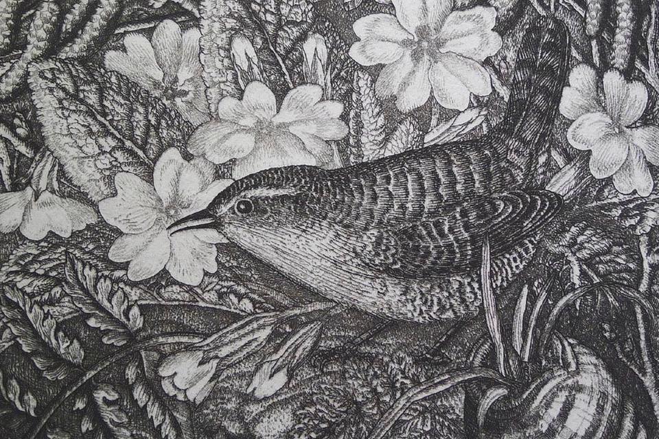
An Artist in the Lane
The footpath that crosses Jacksoms Lane and runs along Birds Marsh towards Chippenham must have been used by many generations of Kington Langley’s inhabitants, but none can observed it and written so sensitively about it as Robin Tanner.
Read More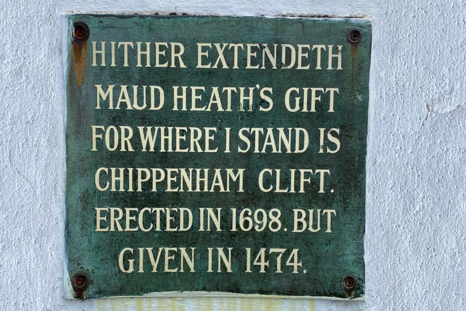
Maud Heaths Inscription
Chippenham
In 1698, large upright stone markers were placed to denote the start at and end of the causeway.
Read More
Site of Old Parsonage
Church of St Peter's
The church of St Peter’s at Langley Burrell is fortunate in having a good-sized car park in front of it. It may surprise some that this is not merely the result of good fortune but rather because there was once a building here.
Read More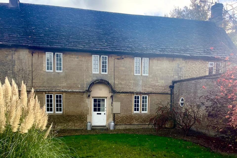
Home Farm
Home Farm was a dairy farm run by the Bryant family for much of the nineteenth century. (Mary) Catherine Bryant took over the 100 acre plus concern independently when her husband died in 1863, leaving her with a young family.
Read More